
The Planning Application
The forthcoming planning application will be outline form with all matters reserved (except for primary means of access to the highway) – this means that only the principle of development, alongside initial design parameters and details of access will be considered. Should outline planning permission be granted, there is a further stage (Reserved Matters) which provides further details on the appearance, layout, scale and landscaping.
The outline application will include supporting technical and environmental reports and assessments setting out mitigation measures to ensure the development can be accommodated on this site in a sustainable way.
Financial contributions would be made as appropriate towards social and community facilities, such as schools and health provision, to accommodate the people who will live in the homes.


Environment, landscape, green spaces and biodiversity
A Green Infrastructure Plan and Strategy and Landscape and Visual Impact Assessment would form part of the planning application. The comprehensive, landscape-led strategy that balances new housing with environmental stewardship and heritage conservation.
The site currently has a low existing ecological and biodiversity value and the development will deliver a material biodiversity net gain. Habitat assessments, protection and mitigation measures form a key part of the proposals, as well as details as to how at least +10% Biodiversity Net Gain can be achieved and protected. Robust assessments of the site’s baseline value in terms of habitats and species are currently underway, and will ensure that a detailed avoidance, mitigation and compensation package is designed for the site through delivery of a Biodiversity Gain Plan, Habitat Management and Monitoring Plan and Construction and Environmental Management Plan.
Pinsley Wood (Ancient Woodland) will be retained and protected. Pockets of smaller woodland blocks and scattered hedgerow trees throughout the landscape, create a wooded setting. The woodland edge will be enhanced with a new planted buffer zone which will help mitigate any potential edge effects and provide new habitats and ecological connectivity. This buffer will mitigate direct the effect of noise, lighting, encroachment both during construction and operation, and also improves/extends the woodland, providing additional nesting, foraging and commuting opportunities for species known to be present within the woodland (bats, birds, etc…)
The site primarily contains managed mature hedgerows and scattered individual trees largely confined to the field boundaries. This will allow development to be integrated within the existing field patterns and retain/preserve the majority of hedgerows and trees. Retained trees and hedgerows will be protected during the development of the site in accordance with BS5837:2012.
Existing habitats of higher value (hedgerows, mature trees, pond, valuable grassland) will be retained and integrated into the green infrastructure.
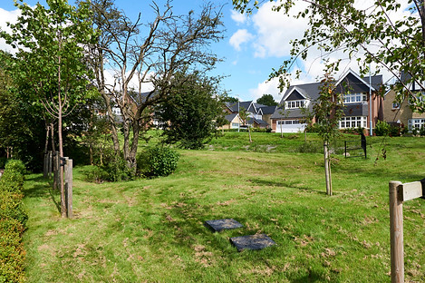
A grassland/under tree canopy planting habitat will be created north of Pinsley Wood, retaining and enhancing grassland and native trees, and restoring a pond.
Open space is planned next to the Old Farmhouse to preserve its historical setting.
The railway line north of the site dissects the landscape and
provides physical and visual separation of the site from the
Cotswolds National Landscape and the Blenheim Palace World
Heritage Site to the north.
There are numerous public rights of way within the local area
which create a well-connected landscape between the
settlements and the wider countryside. These can be
improved.
The development can also facilitate the last section of a direct
walking and cycling route between the Salt Cross Garden
Village and Hanborough station.
Climate protection
-
A sustainability and energy strategy will accompany the planning application.
-
The homes will be modern, well-insulated, energy efficient and healthy.
-
All electric – no fossil fuel use on site.
-
Passive design and fabric first approach to reduce the need to heat and cool homes.
-
On site renewable energy provision could include air source heat pumps, mechanical ventilation and /or solar PV.
-
Built in line with Future Homes Standard as a minimum.
-
Water efficiency measures built in.

-
Buildings that respond to the environment and are adaptable to future technologies.
-
A healthy, accessible community with access to sustainable travel opportunities – including bus and rail services and footpaths/cycleways.
-
New tree planting will include a broad and diverse range of tree species to help build in resilience within the tree stock in relation to climate change and pest and disease.
-
New planting will Include a range of stock sizes to help create a more diverse age structure within the tree stock at the site.
Flood risk, drainage and foul water
Environment Agency mapping indicates that the site is at a low probability of flooding.
The site will be developed using sustainable drainage principles with surface water runoff from roofs and hardstanding areas carefully managed, discharging into local watercourses, restricting runoff to existing greenfield rates and incorporating Sustainable Drainage Systems (SuDS) across the site to attenuate and treat runoff and provide new habitats
Foul water will likely be pumped to facilitate a connection into the local public sewerage network.
A Flood Risk and Drainage Assessment will be produced in line with policy and local guidance. This will assess the flood risk posed from all sources and demonstrate that the proposed development will have no detrimental effects on flood risk in the wider catchment, as well as outlining any mitigation measures.
Utilities
The outline planning application will be accompanied by a Utility Assessment which will obtain and appraise all existing utilities record information in the vicinity of the site to ensure existing utility assets are coordinated with as far as practicable.
The assessment will also include the anticipated utility requirements for the proposed development and evidence that the required infrastructure is deliverable without adversely impacting the local utility networks. This will include provision for electricity, potable water & gigabit-ready broadband infrastructure. This will include the provision of new onsite Electricity substations to service the development.
A new adoptable foul pumping station would be delivered, and as Thames Water has a legal responsibility to provide adequate sewerage services, the grant of any planning permission would enable them to prepare and subsequently carry out any required upgrade works to the public sewerage network.
Engagement is ongoing with Thames Water to agree an infrastructure phasing programme which will ensure that upgrades to the foul network are delivered in line with the housing.
Travel and transport
-
A Vision Led Transport Assessment (TA) and Sustainable Travel Plan will form part of the planning application. This will include assessments into the effects on local roads and junctions and we are working with the local highway authority to look at the mitigation measures and improvements required to accommodate the development.
-
The Travel Plan will explore the opportunity to provide sustainable travel initiatives– for example bus travel vouchers or e-bike access so residents here don’t need to own a car.
-
A road link between Regent Drive and Lower Road will provide the opportunity for buses to directly serve the railway station as part of the proposed rail and bus interchange and mobility hub.
-
The Regent Drive / Lower Road link will also provide improved vehicular connectivity, for example by providing a more direct route from Lower Road to Hanborough Station
-
There are opportunities to provide improved crossing facilities on Main Road.
-
Cycle storage and EV charging will be provided at each home.
-
Good broadband will maximise the potential to work from home and reduce vehicle trips.
-
Pedestrian routes within the site and the improvedpublic rights of way through the site will deliver better sustainable connectivity.
-
New vehicular access will be formed on Lower Road, providing the opportunity to route demand away from the existing community.
